Vessels engaging in clandestine activities turn off their transponders to hide from authorities. Skybase can see them nonetheless, thanks to a novel combination of satellite, drone and IoT device data.
AIS has been improving safety on high seas for over two decades now. Originally a tool meant for pure visibility and collision avoidance, it has also become a useful tool in gathering aggregate maritime data.
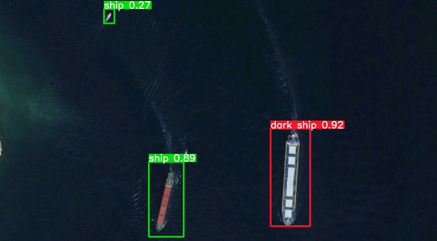
However, this being a self-reported signal, nefarious actors engaged in illegal activities simply turn off their transponders to avoid both immediate detection and future evidence against them. Ships engaged in illegal fishing, human trafficking and even buying oil from sanctioned countries have been reported many times with their transponders off. They simply use the vastness of the oceans to hide.
Skybase turns the tables on this practise by discovering the ships regardless through other means and transforming the absence of AIS to a marker of interest. We detect ships from multiple satellites and deployed sensors using AI, then we match these detections with both terrestrial and spaceborne AIS data. The areas where AIS detections and AI detections do not match are marked as hotspots and targeted for immediate autonomous drone flights for close up confirmation or action.
With Skybase, the coast is always clear.
Please contact us for more information.